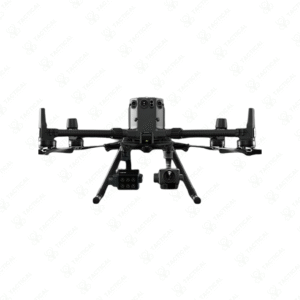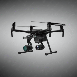


Drone-Based Magnetometer Survey Systems
High-precision UAV-mounted magnetometer platforms engineered for aerial magnetic surveying across UXO detection, archaeology, geology, mineral exploration, and safety reconnaissance.
Key Features:
✔️ Designed for integration with wide range of UAV platforms
✔️ Fluxgate magnetometer sensors deliver reliable three-axis measurements
✔️ Scalable configurations from single-sensor to multi-sensor arrays
✔️ Onboard GPS and data logging for accurate position tagging
✔️ High sampling rates support detailed magnetic mapping and anomaly detection
✔️ Lightweight carbon fiber sensor arms maintain safe positioning beneath UAV
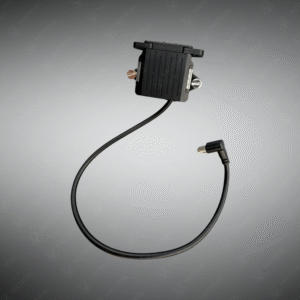
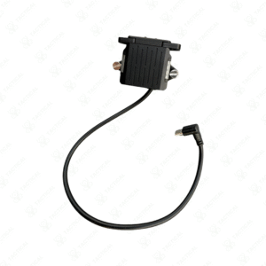
✔️ Includes rechargeable power, rugged transport case, and essential hardware
✔️ Compatible with advanced post-processing tools and GIS workflows
Drone-Based Magnetometer Survey Systems
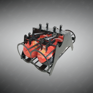
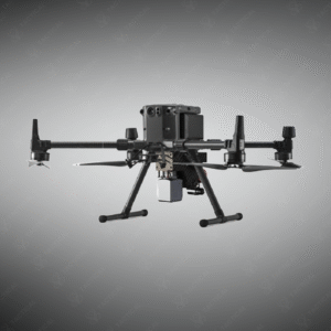
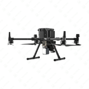
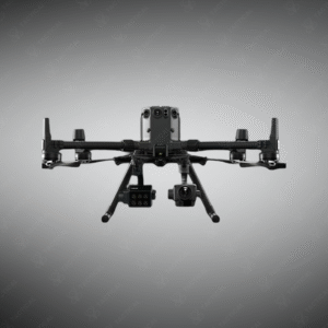
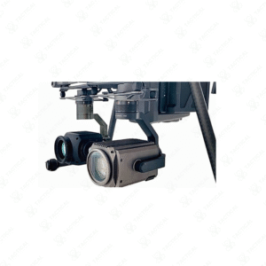
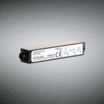
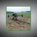
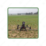
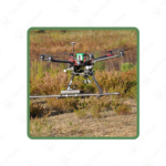
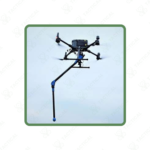
The Drone-Based Magnetometer Survey Systems include three UAV-mountable configurations for aerial magnetic field mapping. The MagDrone R1 requires minimum 1kg payload capacity and features one three-axis fluxgate sensor sampling at 1,000Hz with self-folding carbon fiber mounting arm. The MagDrone R3 incorporates dual three-axis fluxgate sensors operating at 200-250Hz with integrated GPS, internal data logger, and rechargeable battery pack. The MagDrone R4 deploys five three-axis sensors at 200Hz sampling rate and requires drones exceeding 1,500g payload capability.
All systems include rugged transport cases, rechargeable batteries, connection hardware, and MagDrone DataTool software for post-flight processing. The R3 and R4 models feature onboard Wi-Fi servers enabling wireless configuration and data download without physical connections. Sensor arrays mount on lightweight frames designed to position magnetometers away from motor interference while maintaining aerodynamic stability during flight operations. Data exports to GIS platforms, MATLAB, and MAGNETO software formats.
Unexploded ordnance clearance contractors deploy Drone-Based Magnetometer Survey Systems across former conflict zones where ground-based survey methods pose safety risks to personnel. Mineral exploration companies use them for rapid reconnaissance mapping over rugged terrain inaccessible to vehicle-mounted sensors. Archaeological research teams conduct non-invasive site surveys detecting buried structures without excavation disturbance. Utility companies employ the technology for pipeline route planning to identify existing subsurface infrastructure before construction authorization.
Tactical Supply Pakistan offers cutting-edge aerial detection platforms for organizations requiring rapid large-area magnetic surveys in challenging geographic conditions throughout Pakistan.
How do multiple sensors in the R4 configuration improve detection compared to single-sensor systems?
The five-sensor array creates spatial gradient measurements that distinguish local anomalies from regional magnetic variations. Multiple simultaneous readings allow mathematical noise cancellation algorithms to filter drone motor interference and atmospheric fluctuations.
- Fast Shipping: We partner with reliable delivery services to make sure your order gets to you quickly. We work hard to ensure every package arrives safely and on time.
- Quick Processing: Your order is processed and prepared for shipping within 24 to 48 hours. This allows us to send it out to you as fast as possible after your payment is confirmed.
- Tracking: Once your order is on its way, we will provide you with a tracking number. You can use this number to easily follow your package's journey and know exactly when it will arrive.
- Nationwide Delivery: We offer delivery to all locations across Pakistan, including major cities and remote areas. No matter where you are, we can get your order to you.
At Tactical Supply Pakistan, our relationship with you doesn't end after a sale. We are dedicated to making the long-term performance and reliability of our high-quality tactical and supplied equipment. Our commitment is to provide you with seamless support and peace of mind.
- Free Installation: We'll set up your new equipment for you, so it's ready to go. You can focus on your work while our engineers handle as per the guidelines for manufacturer.
- Maintenance: We offer quick replacements where necessary, to keep your gear in top condition. Our team will make sure your equipment is always ready when you need it.
- Customer Support: We're always here to help. Our support team is available to answer your questions and assist you long after you've made a purchase.
- Planned Preventative Maintenance: Our service includes preventative maintenance to keep your equipment in peak condition and prevent future issues.
HAVE QUESTIONS?
Fill out the form, and our team will respond promptly to assist with your product inquiries or order support.