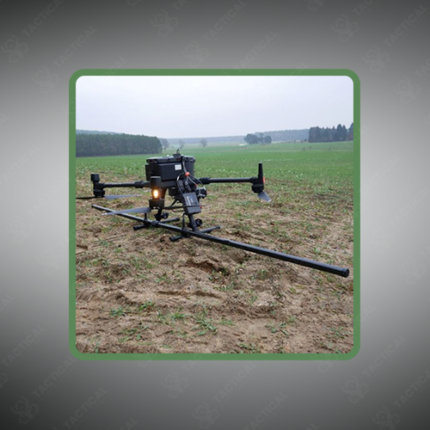
Drone Magnetic Surveys
Drone Magnetic Surveys are geophysical data collection operations that use unmanned aerial vehicles (UAVs) equipped with magnetometer sensors to measure variations in the Earth’s magnetic field across a survey area. By mounting fluxgate, cesium vapor, or optically pumped magnetometer (OPM) sensors on a drone platform, operators can cover large areas of terrain rapidly and at consistent flight altitudes, producing high-resolution magnetic field maps used for geological mapping, mineral exploration, unexploded ordnance (UXO) detection, archaeological site identification, and infrastructure inspection.
The UAV platform — typically a fixed-wing or multirotor drone with a payload capacity between 0.5kg and 5kg — flies pre-programmed survey lines at altitudes ranging from 10 to 120 meters above ground level, maintaining consistent line spacing between 5 and 50 meters depending on the required resolution of the magnetic anomaly map. Sensor sampling rates of 100Hz to 1,000Hz capture detailed field variations along each flight line, with GPS and IMU data logged simultaneously to georeference every magnetic reading to a precise ground coordinate.
Data processing involves applying corrections for diurnal magnetic field variations, aircraft-induced magnetic interference, and GPS positional errors before producing gridded total field intensity maps or vertical gradient maps. Anomaly interpretation identifies subsurface features — mineralized zones, buried metallic objects, geological contacts, and structural boundaries — based on the shape, amplitude, and spatial extent of detected magnetic signatures.
Flight endurance on battery-powered survey drones ranges from 30 to 90 minutes per sortie, with fixed-wing platforms covering up to 50 square kilometers per flight under favorable conditions.
In Pakistan, drone magnetic surveys support mineral exploration in Balochistan and KPK, UXO clearance operations, archaeological surveys, and pipeline route assessment across varied terrain.
Tactical Supply Pakistan supplies drone magnetic survey systems and magnetometer payloads for geological, defense, and field survey procurement nationwide.
Showing the single result