


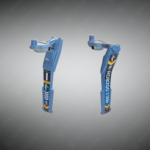
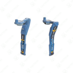
Utility Line Survey Grade Locator
A survey-grade utility line locator that combines advanced locating performance with high-accuracy mapping to detect, position, and document buried utilities in a single field operation.
Key Features:
✔️ Survey-grade GNSS integration for high-accuracy utility mapping
✔️ Advanced utility line locating for metallic buried infrastructure
✔️ Simultaneous locating and mapping to reduce repeat site visits
✔️ Flexible mapping workflows compatible with multiple digital platforms
✔️ High signal stability for reliable results in congested utility corridors
✔️ Multiple active and passive locate modes for versatile field use
✔️ Designed for professional survey, GIS, and utility mapping teams
✔️ Rugged, field-ready construction for demanding outdoor environments
Utility Line Survey Grade Locator
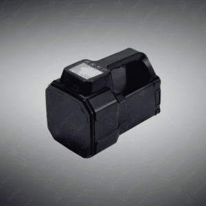
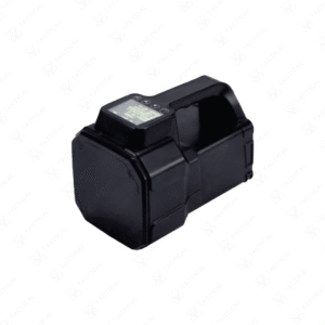
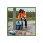
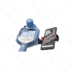
Utility Line Survey Grade Locator integrates electromagnetic signal detection with high-accuracy GPS positioning to trace and document buried infrastructure in one workflow. This system operates through a transmitter-receiver pairing that applies locating signals to conductive utilities, then maps their exact coordinates. The receiver unit connects wirelessly to Android and iOS devices, streaming real-time location data to dedicated mapping applications. Its internal GPS module achieves centimeter-level accuracy when paired with external GNSS corrections, meeting survey-grade standards for utility documentation.
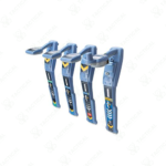
The device features multiple frequency modes ranging from passive power detection to active tracing frequencies up to 200 kHz. Operators can adjust signal strength, select sonde modes for non-conductive pipe tracing, and switch between peak and null detection methods. The transmitter applies direct connection, induction, or clamp signals depending on access points and utility type. Battery life supports full-day field operations, with the receiver housing rated for impact resistance and moisture ingress protection.
Public works departments use the Utility Line Survey Grade Locator to update municipal asset records before road reconstruction. Military base engineers deploy it to verify power and communication lines across training grounds and airfields. Navy port facilities rely on it to map underground fuel lines and electrical conduits in shipyard zones. Airforce installation crews trace buried utilities during hangar expansions and runway modifications to prevent service disruptions.
Tactical Supply Pakistan provides this advanced locating system to professionals who require verifiable subsurface mapping capability. The company delivers tools that support infrastructure planning and regulatory compliance across sectors.
Does the RD8200SG require external correction services for survey-grade accuracy?
Yes, achieving centimeter-level precision typically requires RTK or post-processed GNSS correction data from base stations or subscription services.
- Fast Shipping: We partner with reliable delivery services to make sure your order gets to you quickly. We work hard to ensure every package arrives safely and on time.
- Quick Processing: Your order is processed and prepared for shipping within 24 to 48 hours. This allows us to send it out to you as fast as possible after your payment is confirmed.
- Tracking: Once your order is on its way, we will provide you with a tracking number. You can use this number to easily follow your package's journey and know exactly when it will arrive.
- Nationwide Delivery: We offer delivery to all locations across Pakistan, including major cities and remote areas. No matter where you are, we can get your order to you.
At Tactical Supply Pakistan, our relationship with you doesn't end after a sale. We are dedicated to making the long-term performance and reliability of our high-quality tactical and supplied equipment. Our commitment is to provide you with seamless support and peace of mind.
- Free Installation: We'll set up your new equipment for you, so it's ready to go. You can focus on your work while our engineers handle as per the guidelines for manufacturer.
- Maintenance: We offer quick replacements where necessary, to keep your gear in top condition. Our team will make sure your equipment is always ready when you need it.
- Customer Support: We're always here to help. Our support team is available to answer your questions and assist you long after you've made a purchase.
- Planned Preventative Maintenance: Our service includes preventative maintenance to keep your equipment in peak condition and prevent future issues.
HAVE QUESTIONS?
Fill out the form, and our team will respond promptly to assist with your product inquiries or order support.