


An integrated underground utility mapping solution combining PointMan mobile software with survey-grade GNSS correction services to capture accurate utility position, depth, and field data in real time.
Key Features:
✔️ Mobile mapping software for real-time underground utility data capture
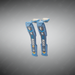
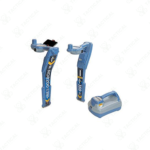
✔️ Records utility depth, GNSS position, and site photos during locating
✔️ Centimeter-level accuracy enabled through RTK correction services
✔️ No external antennas or complex hardware setup required
✔️ Seamless integration with compatible Radiodetection locators
✔️ Cloud-ready workflows for easy data sharing and collaboration
✔️ Field-friendly interface designed for survey and utility professionals
✔️ Supports rapid creation of accurate digital utility maps on site
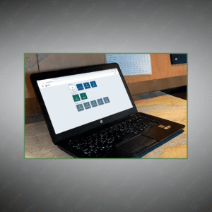
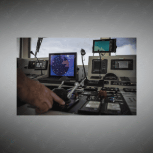
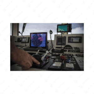
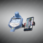
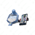
The Underground Utility Mapping Software operates as a mobile application that records utility location data during live field tracing operations. This system pairs with compatible electromagnetic locators to capture depth readings, GPS coordinates, and visual documentation simultaneously. The software runs on Android and iOS devices, eliminating the need for dedicated hardware beyond a smartphone or tablet. Real-time kinematic correction services integrate directly through the app, delivering centimeter-level positioning without external GNSS antennas or base station equipment.
Users launch the application before beginning locate work, then trace utilities as normal while the software automatically logs coordinates and depth measurements. Each utility line appears as a georeferenced vector on the digital map interface. Operators can attach photos, notes, and attribute tags to individual assets during fieldwork. Completed maps export to industry-standard formats including KML, Shapefile, and DXF for integration with GIS platforms and CAD systems. Cloud synchronization enables immediate data sharing across teams and project stakeholders.
Surveying firms use the Underground Utility Mapping Software to document subsurface infrastructure for engineering design projects. Military construction battalions deploy it to create utility atlases for base expansions and facility upgrades. Navy civil engineering corps personnel map underground networks at coastal installations before pier construction or utility relocation. Airforce rapid engineer deployable heavy operational repair squadron engineers trace existing utilities when establishing temporary forward operating locations.
Professionals trust Tactical Supply Pakistan to supply integrated mapping solutions that combine field locators with digital workflow tools. The company supports infrastructure teams transitioning from paper records to georeferenced asset management systems.
Can multiple field crews share mapping data in real time during large site surveys?
Yes, cloud synchronization allows simultaneous data uploads from multiple devices, with changes visible across all connected users as mapping progresses.
At Tactical Supply Pakistan, our relationship with you doesn't end after a sale. We are dedicated to making the long-term performance and reliability of our high-quality tactical and supplied equipment. Our commitment is to provide you with seamless support and peace of mind.
Fill out the form, and our team will respond promptly to assist with your product inquiries or order support.
WhatsApp us