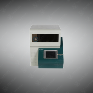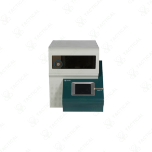


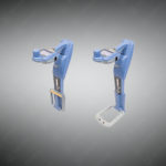
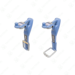
RF Marker Survey Grade Locator
A high-precision survey-grade locator combining RF marker detection, utility line locating, and GNSS-based mapping for accurate underground asset identification and documentation.
Key Features:
✔️ Survey-grade GNSS positioning for high-accuracy underground asset mapping
✔️ Locates RF marker balls for plastic pipes, fiber, and non-metallic utilities
✔️ Advanced utility line locating with multiple active and passive modes
✔️ Supports a wide range of RF marker types and frequencies
✔️ Integrated mapping workflow for direct data capture in the field
✔️ High signal discrimination for congested and complex utility networks
✔️ Rugged, field-ready design for demanding survey environments
✔️ Mobile platform compatibility for data transfer and digital integration
RF Marker Survey Grade Locator
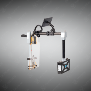
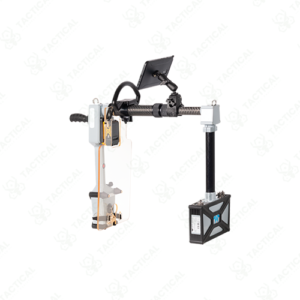
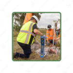
The RF Marker Survey Grade Locator operates on radio frequency technology to detect buried utility markers and underground cables with survey-grade positioning accuracy. This device combines three core functions: advanced line tracing, marker ball detection, and high-accuracy GPS mapping. It features a rugged housing built to withstand field conditions, with compatibility across both Android and iOS platforms for seamless data transfer. The unit integrates onboard GPS that supports digital mapping workflows, allowing operators to log coordinates and export location data directly to GIS systems.
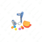
The locator works with multiple RF marker types including marker balls, near-surface markers, mid-range markers, and full-range markers. These passive devices are buried alongside utilities such as plastic pipes, fiber optic cables, and other non-metallic infrastructure. The MRX SG uses radio frequency signals to activate and detect these markers even in congested underground environments. Its dual-antenna system improves detection depth and pinpoint accuracy compared to standard locators.
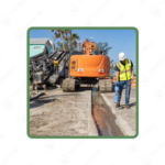
Military engineering units, municipal utility crews, and telecom field teams use the RF Marker Survey Grade Locator to map underground infrastructure before excavation or construction. Navy base operators rely on it to trace buried communication lines across large installations. Airforce facility managers deploy it during runway expansion projects to avoid damaging existing fiber networks. Survey teams in oil and gas sectors use it to verify pipeline routes marked with RF tags.
Tactical Supply Pakistan brings this professional-grade locator to teams who demand reliable subsurface detection tools. The company supports infrastructure professionals with equipment that meets international field standards.
Can the MRX SG differentiate between multiple RF markers buried close together?
Yes, the device’s advanced filtering allows operators to isolate individual marker signals even in areas with high marker density.
- Fast Shipping: We partner with reliable delivery services to make sure your order gets to you quickly. We work hard to ensure every package arrives safely and on time.
- Quick Processing: Your order is processed and prepared for shipping within 24 to 48 hours. This allows us to send it out to you as fast as possible after your payment is confirmed.
- Tracking: Once your order is on its way, we will provide you with a tracking number. You can use this number to easily follow your package's journey and know exactly when it will arrive.
- Nationwide Delivery: We offer delivery to all locations across Pakistan, including major cities and remote areas. No matter where you are, we can get your order to you.
At Tactical Supply Pakistan, our relationship with you doesn't end after a sale. We are dedicated to making the long-term performance and reliability of our high-quality tactical and supplied equipment. Our commitment is to provide you with seamless support and peace of mind.
- Free Installation: We'll set up your new equipment for you, so it's ready to go. You can focus on your work while our engineers handle as per the guidelines for manufacturer.
- Maintenance: We offer quick replacements where necessary, to keep your gear in top condition. Our team will make sure your equipment is always ready when you need it.
- Customer Support: We're always here to help. Our support team is available to answer your questions and assist you long after you've made a purchase.
- Planned Preventative Maintenance: Our service includes preventative maintenance to keep your equipment in peak condition and prevent future issues.
HAVE QUESTIONS?
Fill out the form, and our team will respond promptly to assist with your product inquiries or order support.