


Mobile Magnetic Field Survey System
A self-contained, containerized magnetometer system for recording and analyzing the magnetic signatures of naval vessels worldwide, supporting mine protection and MES system verification.
Key Features:
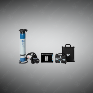
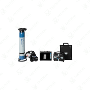
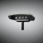
✔️ High-precision 3-axis fluxgate magnetometers for accurate field measurement
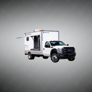
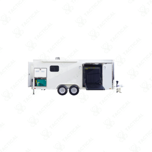
✔️ Self-contained, containerized system for global transport and rapid deployment
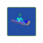
✔️ Records naval vessel magnetic signatures under varying operational conditions
✔️ Supports adjustment and verification of Magnetic Self-Protection (MES) systems
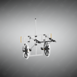
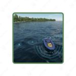
✔️ Flexible offshore deployment of sensors with precise seabed positioning
✔️ Expandable with additional sensors for project-specific needs
✔️ Integrated software for planning, data acquisition, and magnetic analysis
✔️ Measurement station operable up to 2 km offshore for safe surveys
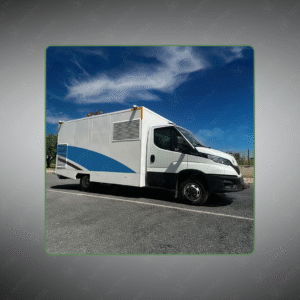
Mobile Magnetic Field Survey System
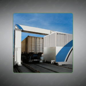
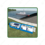
The Mobile Magnetic Field Survey System consists of two standard 20-foot shipping containers housing complete naval vessel magnetic signature measurement capability. The measurement container holds the work station, data acquisition equipment, and analysis software suite. The power container contains electrical generation systems and deployment gear for positioning underwater sensor components. Both containers provide self-contained operation without requiring external infrastructure or utility connections at deployment locations.
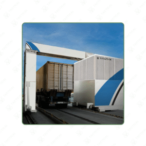
Measurement components deploy offshore using rigid inflatable boat transport and position on the seabed through proprietary calibration procedures ensuring precise sensor location determination. High-precision three-axis fluxgate magnetometers capture vessel magnetic signatures during various operational conditions including different machinery states and degaussing configurations. The measuring station operates up to 2 kilometers from coastal container positioning sites. Software includes planning modules for vessel scheduling, real-time signature recording interfaces, and analytical tools for magnetic self-protection system adjustment verification.
Naval forces deploy the Mobile Magnetic Field Survey System at forward operating bases for verifying degaussing equipment effectiveness before mine-threatened water transit operations. Shipyard facilities use it during new construction commissioning to establish baseline magnetic signatures and calibrate installed magnetic signature reduction systems. Defense research organizations employ the system for evaluating experimental hull treatment materials and alternative degaussing coil configurations. Port authorities utilize it for certifying vessel magnetic safety compliance before granting access to magnetically-sensitive harbor areas containing unexploded ordnance.
Tactical Supply Pakistan provides transportable naval measurement systems for maritime defense organizations requiring worldwide-deployable magnetic signature analysis capability without permanent range infrastructure investment.
Why must magnetometers be positioned on the seabed rather than suspended mid-water during vessel signature measurements?
Seabed placement provides stable reference positioning immune to current-induced sensor movement that would introduce measurement errors. Fixed bottom sensors maintain consistent geometric relationships to vessel transit paths across multiple measurement runs.
- Fast Shipping: We partner with reliable delivery services to make sure your order gets to you quickly. We work hard to ensure every package arrives safely and on time.
- Quick Processing: Your order is processed and prepared for shipping within 24 to 48 hours. This allows us to send it out to you as fast as possible after your payment is confirmed.
- Tracking: Once your order is on its way, we will provide you with a tracking number. You can use this number to easily follow your package's journey and know exactly when it will arrive.
- Nationwide Delivery: We offer delivery to all locations across Pakistan, including major cities and remote areas. No matter where you are, we can get your order to you.
At Tactical Supply Pakistan, our relationship with you doesn't end after a sale. We are dedicated to making the long-term performance and reliability of our high-quality tactical and supplied equipment. Our commitment is to provide you with seamless support and peace of mind.
- Free Installation: We'll set up your new equipment for you, so it's ready to go. You can focus on your work while our engineers handle as per the guidelines for manufacturer.
- Maintenance: We offer quick replacements where necessary, to keep your gear in top condition. Our team will make sure your equipment is always ready when you need it.
- Customer Support: We're always here to help. Our support team is available to answer your questions and assist you long after you've made a purchase.
- Planned Preventative Maintenance: Our service includes preventative maintenance to keep your equipment in peak condition and prevent future issues.
HAVE QUESTIONS?
Fill out the form, and our team will respond promptly to assist with your product inquiries or order support.