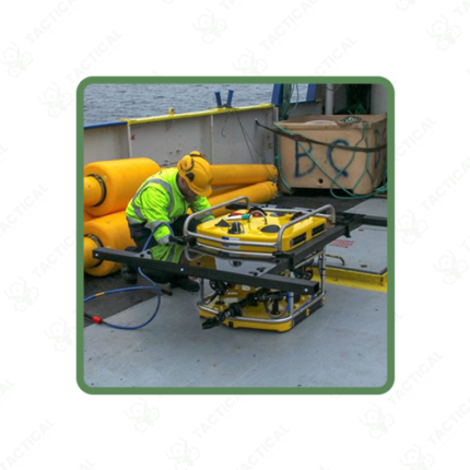
Multichannel Magnetometers
Multichannel magnetometers deploy multiple sensors simultaneously across a survey area or platform — measuring magnetic field values at several spatial positions in parallel to increase survey coverage rate, improve spatial resolution, and enable gradient calculations between sensor pairs that single-sensor instruments cannot provide. These systems serve UXO clearance, archaeological survey, geological mapping, naval magnetic signature measurement, and biomedical imaging applications.
Ground survey multichannel systems mount sensor arrays on wheeled carts, backpack frames, or towed sleds — covering multiple survey lines simultaneously from a single operator pass. The Foerster FEREX array systems deploy 4, 8, or 16 cesium vapor sensors across a frame width of 2 to 8 meters — surveying large clearance areas at walking pace while achieving the tight sensor spacing needed to detect small sub-munitions and ordnance items between sensor positions. Furthermore, simultaneous GPS logging on all channels produces georeferenced multichannel datasets where post-processing software assembles adjacent sensor tracks into continuous anomaly maps covering the full surveyed area without gaps between passes.
UAV-mounted multichannel magnetometer arrays carry 4 to 10 sensors on rigid wing structures extending laterally from the flight path — covering swath widths of 3 to 10 meters per flight line at sensor heights of 2 to 5 meters above the survey surface. These airborne configurations survey large areas impractical for ground walking systems — directly applicable to Pakistan’s former conflict zone UXO clearance programs in KPK and FATA where ground access is restricted. Additionally, marine multichannel towed arrays place sensors at defined lateral and depth separations behind survey vessels — mapping seabed magnetic anomalies across wide corridors for offshore pipeline route clearance and underwater UXO detection along Pakistan’s Makran Coast.
Naval magnetic signature measurement systems place sensor arrays around vessel dry dock positions or underwater ranges — recording the full three-dimensional magnetic field signature of surface ships and submarines at different degaussing coil current settings. This data guides degaussing coil optimization to minimize the vessel’s magnetic signature against bottom-influence mines and magnetic anomaly detection systems.
These systems serve Pakistan Army EOD multichannel UXO clearance programs in former conflict zones, Survey of Pakistan aeromagnetic survey operations, Pakistan Navy vessel degaussing and magnetic signature measurement programs, mineral exploration contractors in Balochistan and Gilgit-Baltistan, and archaeological survey teams at Indus Valley heritage sites requiring high-coverage parallel magnetic data collection.
Tactical Supply Pakistan supplies multichannel magnetometers for UXO clearance, geological survey, naval magnetic signature measurement, and archaeological mapping procurement across Pakistan.
Showing the single result