


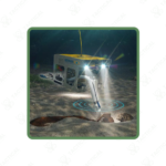


A submersible, high-resolution multi-sensor magnetometer system designed for ROV and offshore platforms to support underwater UXO detection and marine geophysical surveys.
Key Features:
✔️ Multi-channel underwater magnetometer system for offshore and inland surveys
✔️ High-resolution FGM3D UW fluxgate sensors for precise magnetic measurements
✔️ Sensor bandwidth up to 4,000 Hz for detailed anomaly detection
✔️ 24-bit digitization ensures high-quality magnetic data output
✔️ Cascadable architecture allows expansion to larger sensor arrays
✔️ TCP/IP data output enables integration with ROVs, AUVs, vessels, and networks
✔️ Flexible sensor placement for wide-area surveys and pinpoint investigations
✔️ Compatible with major hydrographic and survey software platforms
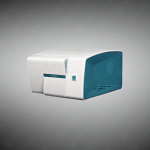
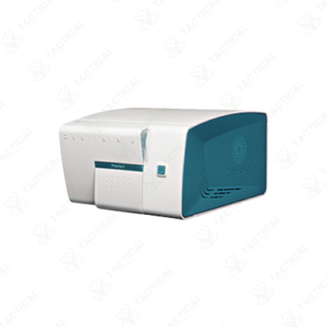
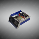
The MX3D UW Multi-channel Magnetic Exploration Magnetometer features FGM3D/100 UW II sensors measuring ±100,000 nanotesla range with noise levels below 15 picotesla RMS per root hertz at 1Hz frequency. Each sensor spans 263mm length and 45mm diameter, weighing 444 grams in air and 182 grams in saltwater. The system operates at 2,000Hz bandwidth standard with 4,000Hz available upon request. The MX3D UW digitizer unit accommodates one to five sensors per module with cascadable configuration supporting expanded arrays.
The data acquisition unit digitizes signals using 24-bit resolution across 15 analog channels plus one RS232 input for auxiliary sensors including GPS, altimeter, and AHRS devices. Sampling rates span 200Hz to 10,000Hz with 10/100 Mbps full-duplex Ethernet output. The digitizer measures 98mm diameter by 324mm length, consuming maximum 10 watts at 200Hz sampling with five connected sensors. Ethernet cable extends to 100 meters using Cat6 specification, expandable via DSL modem for greater distances. Power supply accepts 10-32 VDC input with 2.5-ampere startup current.
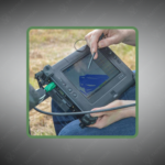
Offshore salvage operators deploy the MX3D UW Multi-channel Magnetic Exploration Magnetometer on ROV platforms for wreck site debris field mapping in deep water recovery operations. Port authorities use it for harbor bottom ordnance surveys clearing shipping channels before dredging activities commence. Subsea cable installation contractors employ the system for route clearance verification detecting ferrous obstructions along planned fiber optic corridors. Marine archaeology teams attach it to AUVs for non-contact shipwreck identification surveys across extensive search grids.
Tactical Supply Pakistan supplies advanced subsea detection technology for marine industry professionals requiring high-sensitivity magnetic anomaly identification in demanding underwater operational environments.
How does the variable sensor spacing capability benefit different survey objectives?
Wide spacing increases coverage area during initial reconnaissance sweeps, reducing survey time over large zones. Close spacing improves spatial resolution for detailed target characterization after initial detection. Operators reconfigure arrays between dives matching sensor geometry to mission phase requirements without returning to shore for equipment changes.
At Tactical Supply Pakistan, our relationship with you doesn't end after a sale. We are dedicated to making the long-term performance and reliability of our high-quality tactical and supplied equipment. Our commitment is to provide you with seamless support and peace of mind.
Fill out the form, and our team will respond promptly to assist with your product inquiries or order support.
WhatsApp us