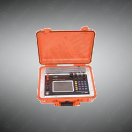
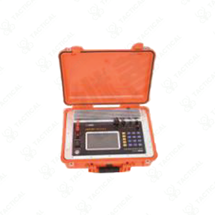
Electromagnetic Transient Electromagnetic System
A transient electromagnetic (TEM) system is a geophysical survey instrument that measures the subsurface electrical conductivity of ground materials by inducing time-varying electromagnetic fields into the earth and recording the decay response of secondary eddy currents generated within conducting bodies below the surface. The transmitter loop, typically a large square or rectangular wire frame laid flat on the ground, carries a pulsed DC current that is abruptly switched off at defined intervals. The sudden current cutoff induces eddy currents in subsurface conductors, and the TEM receiver measures the decaying magnetic field response over time, with the rate and shape of the decay curve indicating the depth, geometry, and conductivity of buried targets.
TEM systems operate effectively at depths ranging from a few meters to several hundred meters depending on transmitter loop size, current output, and ground conditions. Larger transmitter loops and higher current output extend depth penetration, making TEM one of the most capable near-surface and mid-depth geophysical methods for groundwater mapping, mineral exploration, UXO detection, and infrastructure void assessment. Data is processed using inversion software to generate one-dimensional or three-dimensional conductivity models of the subsurface profile.
In Pakistan, TEM systems support groundwater resource surveys in arid regions, geological mapping for infrastructure corridor planning, and subsurface investigation around critical facilities where buried metallic objects or voids represent structural or security concerns. EOD and military engineering teams also apply TEM methodology for large-area buried metallic threat detection in post-conflict terrain assessment.
Tactical Supply Pakistan supplies transient electromagnetic survey systems for geophysical, engineering, and security-oriented subsurface investigation requirements across Pakistan.
Showing the single result