Hyperspectral Imaging Systems
Hyperspectral imaging systems capture, store, and analyze spectral reflectance data across hundreds of narrow wavelength bands for every spatial element in a scene. They identify materials, map compositions, and detect anomalies based on spectral signatures rather than visual appearance. A complete system includes the imaging sensor, spectrometer assembly, detector array, data acquisition hardware, calibration accessories, and post-processing software for spectral classification and output map generation.
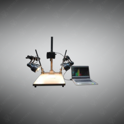
System configurations vary by deployment platform. Airborne systems on UAVs or manned aircraft use pushbroom line-scan sensors synchronized with GPS and IMU data for georeferenced survey acquisition. Ground-based scanning systems use motorized stages or wide-area optics to image sample trays, document surfaces, or field scenes with high spectral precision. Benchtop systems for pharmaceutical, food quality, and forensic inspection use close-range macro optics with controlled illumination to ensure consistent spectral measurements across sample surfaces.
Spectral coverage spans VNIR from 400nm to 1000nm, SWIR from 900nm to 2500nm, and MWIR/LWIR thermal infrared from 3µm to 12µm. Each spectral region identifies distinct material classes including vegetation, minerals, hydrocarbons, plastics, pharmaceuticals, and explosive residues. Software applies spectral angle mapping, principal component analysis, and matched filter algorithms to extract material maps and quantitative composition estimates from the data cube.
Tactical Supply Pakistan supplies hyperspectral imaging systems for mineral exploration in Balochistan, agricultural productivity monitoring, environmental contamination surveys, forensic evidence examination, pharmaceutical quality control, and military intelligence applications requiring spectral material discrimination throughout Pakistan.
Showing the single result