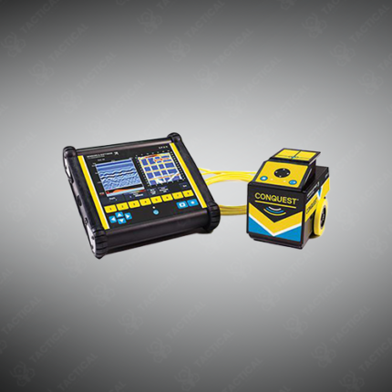
GPR Scanning Equipment
GPR scanning equipment encompasses the full range of ground-penetrating radar hardware used to conduct subsurface investigations across concrete structures, road surfaces, soil, and other materials. A complete GPR scanning setup consists of a transmitter and receiver antenna unit, a control unit or data acquisition system, a display screen for real-time radargram visualization, and a survey wheel or encoder for distance measurement along the scan line. Antenna units are available in shielded and unshielded configurations, with shielded antennas preferred for concrete and pavement scanning where interference from surrounding structures must be minimized.
Antenna center frequencies available across GPR scanning equipment ranges span from 16 MHz for deep geological surveys to 2.6 GHz for high-resolution near-surface concrete inspection. Cart-mounted systems allow the operator to push the antenna along a defined scan line at walking pace while the system records continuous subsurface data, producing a two-dimensional cross-sectional radargram of the scanned profile. Handheld and manually positioned antenna configurations are used in confined spaces, walls, and ceiling applications where cart deployment is impractical.
Data acquired during a scan is stored internally or on removable media and processed using dedicated GPR interpretation software that allows operators to apply gain adjustments, background removal filters, and migration processing to improve target clarity and depth accuracy. Processed data outputs include annotated radargrams, depth slice maps, and three-dimensional subsurface volume models for complex site investigations.
In Pakistan, GPR scanning equipment is deployed by structural engineers, road construction contractors, utility mapping teams, forensic investigators, and military engineering units conducting subsurface assessments across construction sites, urban infrastructure corridors, and security-sensitive facilities.
Tactical Supply Pakistan supplies GPR scanning equipment including antenna systems, control units, and processing software for professional subsurface investigation across Pakistan.
Showing the single result