


Universal Water Detector is a high-power dual-frequency induced polarization (IP) geophysical system designed for accurate groundwater detection, aquifer mapping, and subsurface water hazard assessment.
Key Features:
✔️ Dual-frequency IP method optimized for groundwater exploration
✔️ High-power transmission: 1000V / 20A for deep penetration
✔️ Multiple low-frequency groups for reliable water-bearing zone detection
✔️ High signal-to-noise ratio for stable field data
✔️ Integrated GPS for precise survey point positioning
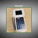
✔️ Real-time resistivity and chargeability display
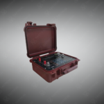
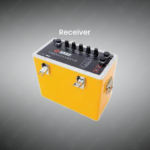
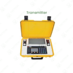
✔️ Rugged, field-ready transmitter and digital receiver design
✔️ Modular system with heavy-duty electrodes and cables
✔️ Efficient deployment by small survey teams
The Universal Water Detector is a geophysical instrument for hydrogeological surveys. It generates a transmission power of 1000 volts and 20 amperes. The system uses the dual-frequency induced polarization method across three specific frequency groups. These include low-frequency pairs like 1Hz/1/13Hz and 4Hz/4/13Hz. An integrated GPS receiver logs precise geographical coordinates for each measurement point. The design achieves a high signal-to-noise ratio (SNR) for reliable data in noisy environments. Its components are engineered for relative portability given the high-power output.
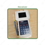
Construction involves a robust transmitter unit and a separate digital receiver. Heavy-duty, insulated cables connect the system to steel electrodes placed in the ground. The housing protects internal electronics from dust, moisture, and field impacts. The receiver unit features a clear display showing real-time apparent resistivity and chargeability readings. The entire setup is modular, allowing a two-to-three-person team to deploy it efficiently in varied terrain.
The Universal Water Detector locates subsurface water resources and geological hazards. Hydrogeologists deploy it to map aquifer boundaries, depth, and saturation in detail. In mining, it identifies dangerous water-filled cavities or fractures ahead of excavation. Agricultural planners use survey data to pinpoint optimal well locations for irrigation. The system is also applied in construction to assess groundwater conditions before building foundations. Operators conduct linear surveys, analyzing the polarization response to find water-bearing zones.
Tactical Supply Pakistan sources the JSPZ-2 for professionals tackling water security and geotechnical challenges. We ensure our clients receive equipment capable of delivering clear, actionable subsurface data.
How does the dual-frequency method specifically distinguish water-bearing structures from other anomalies?
Water-saturated rock or sediment creates a distinct, measurable polarization effect. The instrument compares the response at two simultaneous frequencies. This data highlights anomalies where the electrical chargeability indicates the presence of conductive water, helping differentiate it from clay or metallic mineralization.
At Tactical Supply Pakistan, our relationship with you doesn't end after a sale. We are dedicated to making the long-term performance and reliability of our high-quality tactical and supplied equipment. Our commitment is to provide you with seamless support and peace of mind.
Fill out the form, and our team will respond promptly to assist with your product inquiries or order support.
WhatsApp us


