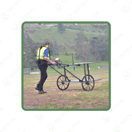
Time Domain Electromagnetics (TDEM or TEM)
Time domain electromagnetics, abbreviated TDEM or TEM, is a geophysical exploration method that transmits electromagnetic pulses into subsurface formations and measures the resulting electromagnetic field decay to determine electrical conductivity structure and identify mineral deposits, groundwater resources, and geological features. This non-invasive survey technique provides detailed subsurface characterization critical for mineral exploration and resource assessment without requiring drilling or excavation.
Operating principle uses a transmitter coil generating brief electromagnetic pulses typically spanning 100 Hz to 10 kHz frequency range. Upon pulse termination, induced electromagnetic fields decay through the subsurface medium. Receiver coils positioned at the survey site measure the decaying field voltage at multiple time delays following pulse transmission. Early-time measurements sense shallow subsurface regions. Late-time measurements penetrate deeper formations, enabling depth-dependent conductivity profiling.
Measured electromagnetic decay patterns reveal subsurface conductivity structure with higher conductivity materials producing faster field decay and lower conductivity materials showing slower decay patterns. Data processing inverts measured decay characteristics into one-dimensional conductivity profiles at each measurement location. Integration of profiles across survey grids generates three-dimensional subsurface conductivity models revealing mineral distribution and geological structure.
Conductivity anomalies identify probable mineral types through characteristic conductivity signatures. Conductive sulfide mineral deposits produce anomalous high-conductivity signatures distinguishing them from barren rock. Groundwater-saturated formations show elevated conductivity compared to dry conditions, supporting aquifer mapping and water resource assessment.
In Pakistan, mineral exploration companies conduct TDEM surveys in Balochistan targeting metal deposits. Groundwater organizations map aquifer extent. Environmental teams characterize contamination. Geotechnical programs assess subsurface conditions for engineering projects.
Tactical Supply Pakistan supplies time domain electromagnetic survey equipment for mineral exploration, groundwater, environmental, and geotechnical applications across Pakistan.
Showing the single result