RTK GPS
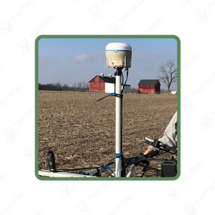
RTK GPS combines a standard GPS receiver with real-time correction data, bringing location accuracy down from a few metres to 1-2cm. A fixed base station sits at a known point and calculates the gap between its GPS reading and its true position. It sends that correction to a rover unit in the field. The rover applies the fix instantly, without any post-processing needed after the survey ends.
Correction data travels over UHF radio or through an internet-based NTRIP connection, depending on what’s available at the site. UHF radio links typically reach 5 to 10 kilometres in open terrain. NTRIP works anywhere with mobile data coverage, useful in cities or near towers where radio range isn’t a concern. Rover units update position 10 to 20 times per second. This makes them fast enough for stakeout, boundary marking, or tracking a moving vehicle in real time.
Handheld controllers pair with the rover through Bluetooth, showing live coordinates on a touchscreen. Most controllers run mapping or CAD-style software, letting field staff mark points, draw boundaries, or export data straight to a project file. Battery life on rover units runs 6 to 10 hours, matching a typical survey day without a mid-shift recharge. Antenna poles come in fixed heights, usually 2 metres, with offset settings built into the software for accurate ground-point calculation.
Construction firms use RTK GPS for site layout, marking foundation corners and grade lines without a full survey crew. Agricultural operations use it for auto-steer planting and irrigation alignment across large fields. Security teams also use RTK GPS to map perimeter fencing, sensor placement, and buried infrastructure with exact coordinates for future reference.
Tactical Supply Pakistan supplies RTK GPS systems to construction firms, agricultural operations, and security infrastructure teams across Pakistan. Base and rover units are available as complete kits or separately based on existing equipment.
Showing the single result