Magnetometer Survey System
Magnetometer survey systems combine a magnetic field sensor, GPS receiver, data logger, and survey software into a complete field platform for detecting and mapping subsurface magnetic anomalies caused by buried metallic objects, geological features, and archaeological remains. These systems serve UXO clearance, mineral exploration, oil and gas geological mapping, pipeline location, and heritage site investigation across ground, airborne, and marine deployment configurations.
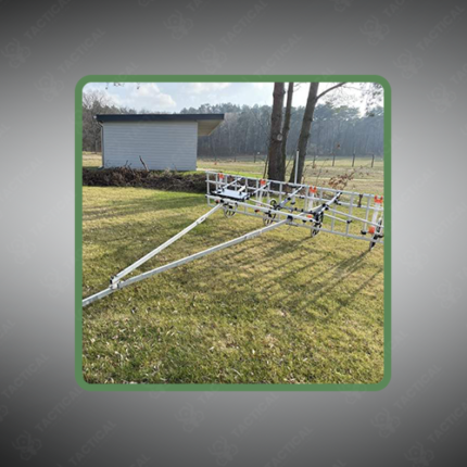
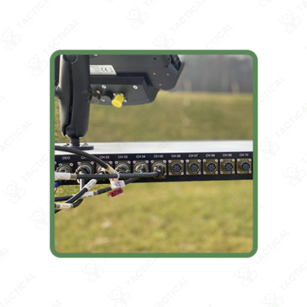
Ground-based walking survey systems use fluxgate gradiometers or cesium vapor total field magnetometers carried on backpack frames or non-magnetic fiberglass poles at sample rates of 5 to 10Hz along pre-surveyed grid lines. The Bartington Grad601 gradiometer achieves sensitivity of 0.3 nT RMS — resolving small ferrous targets including sub-munitions and archaeological iron objects at depths to 1.5 meters. Integrated GPS receivers log position alongside magnetic data at centimeter-level accuracy using PPK post-processing — producing georeferenced anomaly maps without manual grid measurement. Furthermore, multi-sensor cart systems mount 4 to 8 gradiometer sensors across a wheeled frame — covering survey areas up to 400% faster than single-operator walking configurations for large-area UXO clearance and agricultural land release programs.
Airborne magnetometer survey systems mount cesium vapor or Overhauser sensors on fixed-wing aircraft, helicopters, or UAVs — covering hundreds of square kilometers per flight day at line spacings of 50 to 200 meters for regional geological mapping or 2 to 5 meters for high-resolution UXO detection. UAV-mounted systems such as the Geometrics MagArrow II carry MFAM sensors in a stabilized aerodynamic housing — flying at 3 to 5 meters above the survey surface at speeds of 5 to 10 m/s for detailed UXO and archaeological target detection. Additionally, marine towed magnetometer systems drag sensor birds at defined depths behind survey vessels — mapping seabed magnetic anomalies for offshore pipeline route clearance, shipwreck location, and underwater UXO detection along Pakistan’s Makran Coast and Arabian Sea offshore blocks.
Data processing software converts raw magnetic readings into total field, gradient, and analytic signal maps — identifying anomaly positions, depths, and estimated target masses for prioritized excavation or avoidance marking on clearance operations.
These systems serve Pakistan Army EOD UXO clearance programs in KPK and FATA, mineral exploration contractors in Balochistan and Gilgit-Baltistan, Survey of Pakistan aeromagnetic mapping operations, offshore oil and gas survey contractors in the Arabian Sea, and archaeological survey teams at Indus Valley and Gandhara heritage sites across Pakistan.
Tactical Supply Pakistan supplies magnetometer survey systems for UXO clearance, mineral exploration, airborne geological survey, and archaeological mapping procurement across Pakistan.
Showing the single result