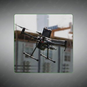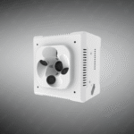
The Drone Photography & Mapping Camera is a high-resolution multi-lens imaging system for aerial mapping, surveying, and cadastral data collection.
Key Features
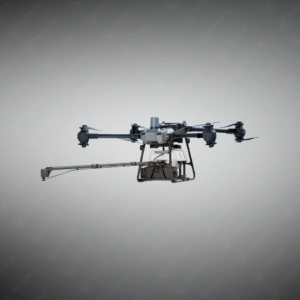
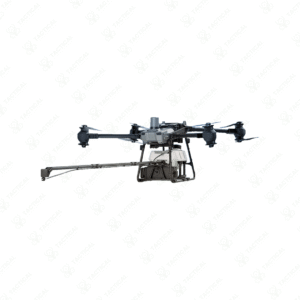
✔️ Five-lens configuration with 120 MP total on APS-C sensors
✔️ Central nadir lens 25 mm, four oblique lenses 35.6 mm focal length
✔️ Individual lens captures 24.3 MP at 3.92 µm pixel size (6000×4000 px)
✔️ Mechanical shutter 1/1000 s with minimum stability 0.8 s
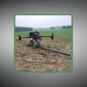
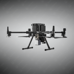
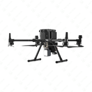
✔️ Aluminum alloy body weighs 650 g, dimensions 122×122×105 mm
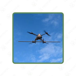
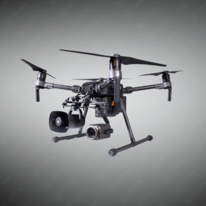
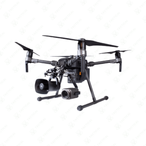
✔️ Direct mount via DJI SkyPort on Matrice 200, 210 RTK, 300 RTK
✔️ Aircraft power 20 W, no additional batteries required
✔️ Internal 640 GB storage for full-resolution sequences
✔️ Embedded POS metadata ensures compatibility with DJI Terra and third-party software
✔️ Supports automatic route planning for complete area coverage and oblique imagery
The Drone Photography & Mapping Camera features five lens elements totaling 120 megapixels across APS-C format sensors. One central nadir-pointing lens at 25 millimeters focal length pairs with four oblique lenses at 35.6 millimeters for simultaneous multi-angle capture. Individual lens arrays deliver 24.3-megapixel resolution at 3.92-micron pixel size, generating 6000 by 4000 pixel images. Mechanical shutter operates at 1/1000-second speed with minimum 0.8-second stability intervals. Aluminum alloy construction weighs 650 grams and measures 122 by 122 by 105 millimeters.
DJI Payload SDK integration mounts directly to SkyPort gimbal interfaces on Matrice 200, 210 RTK, and 300 RTK platforms. Aircraft power systems energize the 20-watt camera assembly without supplementary batteries. DJI datalink transmits image data and metadata through single unified interface. Internal 640-gigabyte storage accommodates full-resolution image sequences. Time synchronization algorithms embed original position and orientation (POS) data directly into photograph file attributes, ensuring compatibility with DJI Terra and third-party processing software. Automatic route expansion calculation optimizes subsequent flight path planning for complete coverage.
Cadastral surveyors deploy the Drone Photography & Mapping Camera to achieve 1.5-centimeter ground resolution for property boundary documentation and municipal tax assessment mapping. Urban planners capture multi-scale imagery for infrastructure planning and zoning analysis. Real estate developers document construction progress and site conditions. Smart city initiatives use oblique perspectives for traffic monitoring and public facility assessment. Emergency responders acquire damage assessment imagery and tactical situation awareness.
Tactical Supply Pakistan supplies this integrated aerial imaging solution to surveying teams and government agencies requiring high-accuracy three-dimensional mapping capabilities from enterprise-grade drone platforms.
Why is embedded POS data critical for aerial mapping accuracy?
Embedded position and orientation metadata eliminates ground control point requirements and reduces processing time. Direct DJI Terra compatibility enables immediate data workflow without external coordinate conversion steps.
At Tactical Supply Pakistan, our relationship with you doesn't end after a sale. We are dedicated to making the long-term performance and reliability of our high-quality tactical and supplied equipment. Our commitment is to provide you with seamless support and peace of mind.
Fill out the form, and our team will respond promptly to assist with your product inquiries or order support.
WhatsApp us