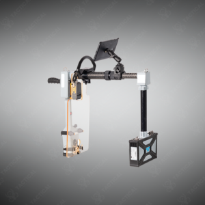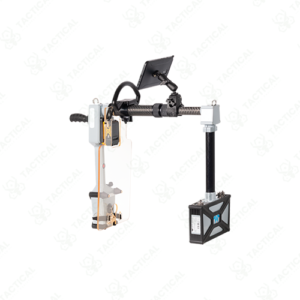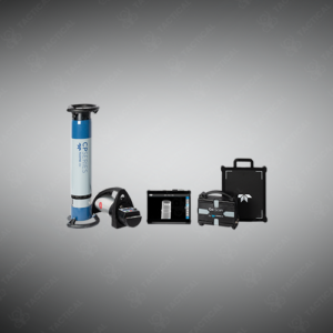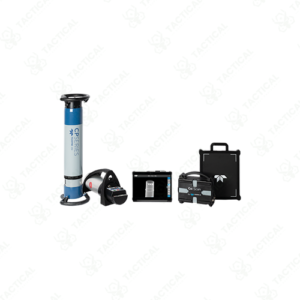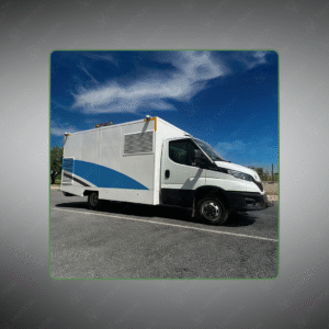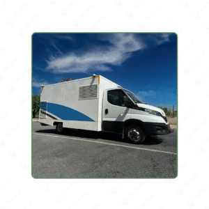


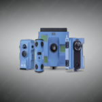
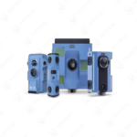
3D Laser Scanner is a Mobile, high-precision 3D mapping and imaging system.
Key Features:
✔️ Mobile terminal operation with GPS/BeiDou positioning
✔️ 3 multi-layered LiDAR, 905 nm wavelength, Class 1 eye-safe
✔️ Scanning range: 0.6 m–260 m, accuracy ≤1 cm at 20 m
✔️ High-speed point cloud capture: 300k pts/s (single), 600k pts/s (dual)
✔️ Field of view: 360° horizontal × 267° vertical
✔️ 16 K HD panoramic imaging with 1 HD camera
✔️ Point cloud output formats: .las, .ply, compatible with AutoCAD
✔️ Built-in 128 GB storage, 4-hour replaceable battery
✔️ Wi-Fi 2.4/5 GHz support, online browsing of scans
✔️ Lightweight and compact: 6.75 kg, 312×305×146.5 mm
The 3D Laser Scanner features three multi-layered 905nm wavelength lidars scanning at 300,000 points per second in single echo mode and 600,000 points per second in dual echo. It captures data from 0.6m to 260m with 360° horizontal and 267° vertical field of view. The unit achieves ≤1cm accuracy at 20m with 80% target reflectivity and ≤2cm accuracy at 0.2-1m with 30% reflectivity, outputting 1cm point cloud density in .las and .ply formats.
This Class 1 eye-safe laser mapping scanner weighs 6.75kg with dimensions of 312mm x 305mm x 146.5mm and operates via mobile terminal control. It includes one HD camera producing 5472×3648 single images and 16384×8192 panoramic resolution with four light sensors. The device integrates GPS/BeiDou positioning, 128GB cloud storage, 802.11a/b/g/n WiFi supporting 2.4/5GHz communication, and replaceable battery providing 4-hour operation between 0°C and 40°C. Data imports to AutoCAD and third-party software for analysis.
Crime scene reconstruction teams deploy the 3D Laser Scanner at homicide investigations, traffic collision sites, and officer-involved shooting locations to document spatial relationships and trajectory analysis. Accident investigation units use this system to capture vehicle positions, debris patterns, and roadway conditions immediately after incidents. The technology produces courtroom-ready 3D models allowing investigators to measure distances, angles, and sight lines years after evidence collection without returning to modified scenes.
Tactical Supply Pakistan provides this laser mapping solution to forensic units requiring accurate spatial documentation with panoramic imaging for complex scene analysis and expert testimony preparation. The SFM+SLAM relocalization algorithms enable rapid digital archiving.
How does dual-echo scanning improve accuracy in challenging conditions?
Dual-echo lidar processes both initial and secondary pulse returns—when scanning through vegetation or near transparent surfaces, the first echo captures foreground objects while the second echo maps background structures behind them.
At Tactical Supply Pakistan, our relationship with you doesn't end after a sale. We are dedicated to making the long-term performance and reliability of our high-quality tactical and supplied equipment. Our commitment is to provide you with seamless support and peace of mind.
Fill out the form, and our team will respond promptly to assist with your product inquiries or order support.
WhatsApp us