Pipe & Cable Locators
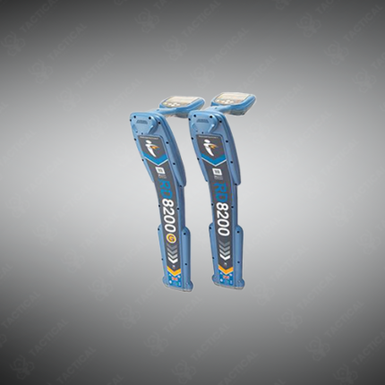
Pipe and cable locators are electromagnetic survey instruments used to detect and trace the underground path of buried metallic pipes, electrical cables, fiber optic conduit armoring, and communication ducts without requiring excavation of the survey area. These tools form standard equipment for utility contractors, civil engineers, and military engineering units operating in environments where unmarked or poorly documented underground infrastructure creates strike risk during ground disturbance activities.
Detection operates through two fundamental methods. Active mode uses a signal transmitter to inject a specific frequency electromagnetic signal onto the target conductor through direct connection at an access point or through inductive coupling from a surface-placed transmitter coil directly above the buried line. The receiver wand carried by the operator detects this induced signal above ground as the survey walk progresses along the suspected utility route. Additionally, passive mode allows the receiver to pick up electromagnetic emissions naturally present on live electrical cables and some metallic pipes without requiring transmitter deployment, supporting rapid preliminary surveys across sites where transmitter access to conductor endpoints is unavailable.
Frequency selection across multi-frequency locator models covers ranges from 50 Hz power frequency up to 200 kHz, with lower frequencies penetrating deeper soil profiles and higher frequencies providing sharper signal definition on congested utility corridors where multiple buried conductors run in close parallel. Detection depth on standard instruments reaches 3 to 5 meters under favorable soil conductivity conditions, with performance varying in high-conductivity wet clay soils common across Punjab’s agricultural zones. Furthermore, depth measurement accuracy on quality locator instruments runs within plus or minus 5% of actual burial depth under controlled conditions with a single isolated conductor target.
Display systems on current locator receivers combine a graphical signal strength bar, numerical depth readout, and an audio pitch tone that rises with signal intensity, guiding the operator along the utility route without requiring continuous display monitoring during the survey walk. Moreover, data logging variants store GPS-tagged depth and signal readings at regular intervals for post-survey utility mapping and GIS platform integration.
Tactical Supply Pakistan supplies pipe and cable locators to utility maintenance contractors, telecommunications infrastructure teams, municipal engineering departments, and military engineering formations requiring dependable underground utility detection across construction and infrastructure projects throughout Pakistan.
Showing the single result