Magnetic Survey
Magnetic Survey is a geophysical exploration method that measures variations in the Earth’s magnetic field across a defined area to identify subsurface features including mineral deposits, geological structures, buried metallic objects, and archaeological remains without requiring invasive excavation. Mining companies and ordnance clearance teams conduct magnetic surveys because the technique reveals subsurface anomalies efficiently and at lower cost than other geophysical methods for many target types. Therefore, magnetic survey often serves as the first reconnaissance tool deployed before more expensive and time-consuming exploration techniques.
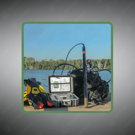
Survey data collection uses magnetometer sensors mounted on ground-based, vehicle-towed, drone-mounted, or airborne platforms depending on the required survey area and resolution. Furthermore, ground-based foot traverse surveys provide the highest spatial resolution but cover limited area per day, while airborne and drone-based surveys cover substantially larger areas more rapidly at somewhat reduced near-surface resolution. Consequently, survey planners select platform type based on the trade-off between coverage area, time constraints, and required target resolution.
Sensor sensitivity directly affects which subsurface features a survey can detect. Fluxgate magnetometers with 0.1 to 1 nanotesla resolution suit general geological mapping and large ferrous object detection, while cesium and potassium vapor magnetometers achieving sub-0.001 nanotesla sensitivity resolve subtle anomalies associated with disseminated mineralization or smaller buried targets. Additionally, line spacing and survey altitude or sensor height above ground directly determine spatial resolution, with tighter spacing required for detecting smaller or more weakly magnetic targets.
Data processing applies diurnal variation correction, removing temporal field changes caused by solar activity, before gridding the corrected readings into total magnetic intensity maps. Moreover, derivative products including reduced-to-pole and vertical gradient maps sharpen anomaly boundaries, supporting more precise target interpretation and drill target selection.
In Pakistan, magnetic surveys support mineral exploration across Balochistan and Khyber Pakhtunkhwa, military UXO clearance operations, archaeological site investigation, and pipeline route assessment. Tactical Supply Pakistan supplies magnetometer equipment and survey systems for geological and defense procurement across Pakistan.
Showing the single result