Walking Profilometer
Portable walking profilometer for on-site road surface assessment—single-operator use with GPS mapping and real-time profile analytics.
Key Features:
✔️ Measures IRI, rut depth, inclination, max deviation and more in real time
✔️ Lightweight, wheeled design for easy rolling by one person
✔️ Selectable measurement modes with instant display of key parameters
✔️ Integrated GPS logs coordinates for each survey point
✔️ USB or Bluetooth export of data to PC
✔️ Stores up to 40 km of profile data with 100 mm steps at 0.1‑mm resolution
✔️ Operates 18 h on AA batteries; rugged weatherproof IP65 build
✔️ Measures slopes ±30° with 0.01° accuracy; compact 70×40×20 cm, 3 kg
Walking Profilometer – GAPMAN: Lightweight Road Surface Diagnostic Tool
Walking Profilometer
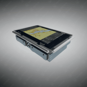
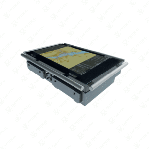
The Walking Profilometer (GAPMAN) is a lightweight, wheeled road surface assessment device designed for accurate measurement of roughness, rutting, and surface inclination. It calculates key pavement condition metrics such as the International Roughness Index (IRI), rut depth, and average angle of inclination in real time. Built for single-operator use, this profilometer includes both a sensor and control module, connected by an adjustable handle, allowing efficient data collection across various terrain types with minimal physical effort.
This device offers selectable measuring modes to identify maximum surface deviation, assess profile uniformity, or monitor slope variation. Its onboard display shows instant results per measured meter in IRI mode, and stores up to 40 km of measurement data internally. An integrated GPS module tags each measurement with geographic coordinates, enabling traceable, location-based reporting for engineering and compliance purposes. Data can be exported via USB or Bluetooth for further analysis or digital recordkeeping.
This Walking Profilometer is deployed in defense infrastructure maintenance, airfield inspection, temporary road validation, and civil engineering projects where reliable field data is essential. Its 100 mm measuring step and 0.1 mm vertical resolution provide detailed surface insights, while the IP65-rated housing ensures operation in harsh outdoor conditions. With a weight of just 3 kg and 18-hour battery life, it supports long-duration fieldwork without operator fatigue or complex setup.
Tactical Supply Pakistan offers this profilometer to support military engineers and infrastructure teams requiring real-time, GPS-tagged profiling for rapid deployment zones and field assessment tasks.
Can this Profilometer be used on unpaved or gravel roads?
Yes, the device is capable of measuring surface roughness and slope on both paved and unpaved roads, provided the terrain allows smooth wheel movement across the testing path.
- Fast Shipping: We partner with reliable delivery services to make sure your order gets to you quickly. We work hard to ensure every package arrives safely and on time.
- Quick Processing: Your order is processed and prepared for shipping within 24 to 48 hours. This allows us to send it out to you as fast as possible after your payment is confirmed.
- Tracking: Once your order is on its way, we will provide you with a tracking number. You can use this number to easily follow your package's journey and know exactly when it will arrive.
- Nationwide Delivery: We offer delivery to all locations across Pakistan, including major cities and remote areas. No matter where you are, we can get your order to you.
At Tactical Supply Pakistan, our relationship with you doesn't end after a sale. We are dedicated to making the long-term performance and reliability of our high-quality tactical and supplied equipment. Our commitment is to provide you with seamless support and peace of mind.
- Free Installation: We'll set up your new equipment for you, so it's ready to go. You can focus on your work while our engineers handle as per the guidelines for manufacturer.
- Maintenance: We offer quick replacements where necessary, to keep your gear in top condition. Our team will make sure your equipment is always ready when you need it.
- Customer Support: We're always here to help. Our support team is available to answer your questions and assist you long after you've made a purchase.
- Planned Preventative Maintenance: Our service includes preventative maintenance to keep your equipment in peak condition and prevent future issues.
HAVE QUESTIONS?
Fill out the form, and our team will respond promptly to assist with your product inquiries or order support.