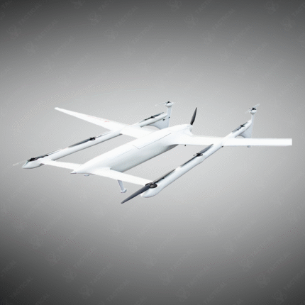
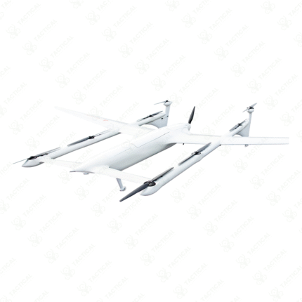
The WingtraOne VTOL drone for mapping and surveying
The WingtraOne is a pioneering Vertical Take-Off and Landing (VTOL) drone specifically engineered for professional mapping and surveying. It takes off and lands like a helicopter for easy deployment in confined areas, then transitions to efficient fixed-wing flight for covering large areas (up to 10 km² per flight) with high endurance. Equipped with high-resolution RGB, multispectral, or LiDAR payloads, it captures survey-grade geospatial data for applications in topography, mining, agriculture, and construction. Its PPK/RTK GNSS systems provide centimeter-level accuracy, making it an industry standard for drone-based geomatics.
-
VTOL design for easy launch/recovery without a runway, combined with fixed-wing efficiency for long range.
-
Carries professional payloads: 42 MP RGB, 5-band multispectral, or high-density LiDAR.
-
Provides survey-grade accuracy with PPK/RTK GNSS for centimeter-precise georeferencing.
-
Used for creating orthomosaics, digital surface models (DSMs), and volumetric calculations.
-
Applications in precision agriculture, quarry and mine surveying, and urban planning.
-
A complete turnkey solution for professional surveyors and GIS teams.
Map large areas with pinpoint accuracy. Utilize the WingtraOne VTOL drone from Tactical Supply Pakistan for professional surveying and mapping.
Showing the single result