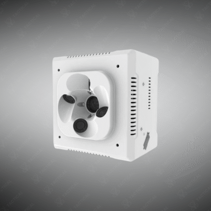
Drone Mapping Camera
A Drone Mapping Camera is a specialized sensor payload designed for aerial photogrammetry and remote sensing, enabling the creation of highly accurate 2D orthomosaics and 3D models. Unlike standard cameras, mapping cameras are calibrated for geometric precision, often featuring a global shutter to eliminate motion blur, high-resolution sensors, and fixed-focus lenses with minimal distortion. They are used with flight planning software to capture thousands of overlapping geotagged images, which are then processed into detailed maps, digital elevation models (DEMs), and volumetric measurements for surveying, construction, agriculture, and environmental monitoring.
Key Features for Precision Mapping:
– Global Shutter Sensor: Captures images without rolling shutter distortion, essential for accurate measurements from a moving drone.
– Radiometric Calibration: Ensures consistent light and color values across all images for reliable analysis (e.g., NDVI in agriculture).
– Fixed-Focus & Calibrated Lens: Minimizes optical distortion and maintains a consistent interior orientation, critical for survey-grade accuracy.
– GPS/PPK/RTK Integration: Often synchronized with high-precision GNSS receivers to geotag each image with centimeter-level accuracy, reducing the need for ground control points.
– High Overlap Capture: Automated flight planning ensures 70-80% front and side overlap between images for successful 3D reconstruction.
– Multispectral Options: Many mapping cameras offer multiple sensors (Green, Red, Red Edge, NIR) for advanced analysis like crop health monitoring.
Generate survey-grade maps and models from the air. Equip your UAV with a professional Drone Mapping Camera from Tactical Supply Pakistan.
Showing the single result