

A handheld data recording software for SENSYS electromagnetic and magnetometer systems, enabling planning, measurement, and on-site visualization of field and borehole data.
Key Features:
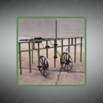
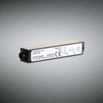
✔️ Compatible with SBL10, DBL15, MAGNETO BM2, and SMD12 systems
✔️ Runs on Windows Mobile handheld devices for field deployment
✔️ Enables planning and execution of area and borehole surveys
✔️ Immediate visualization as color maps or borehole track diagrams
✔️ Supports Bluetooth GPS integration for georeferenced measurements
✔️ Measures fields in line mode for accurate spatial data capture
✔️ Streamlines on-site assessment and project decision-making
✔️ Lightweight, portable, and user-friendly for field operations
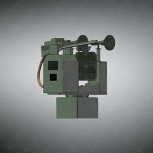
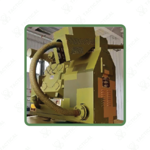
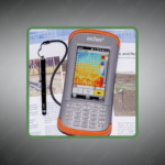
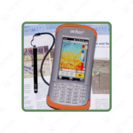
The Data Recording Handheld Device operates MonSX software on Windows Mobile platforms to capture measurements from SBL10, SMD12, DBL15, and MAGNETO BM2 sensor systems during field operations. This application manages project creation, survey planning, and real-time data visualization on ruggedized handheld computers. Users configure measurement parameters and grid layouts before commencing area surveys or borehole investigations.
The software generates color contour maps immediately after area scans, displaying magnetic or electromagnetic field distributions without post-processing delays. Borehole measurements appear as track diagrams showing sensor readings versus depth profiles for instant subsurface analysis. Bluetooth GPS receivers connect wirelessly to enable line-mode surveying where the device records continuous measurements along traverses rather than fixed grid points. GPS integration also georeferences borehole locations automatically during multi-site investigations.
Explosive ordnance disposal technicians use the Data Recording Handheld Device to document clearance operations and generate site maps showing detected munitions before excavation teams begin recovery work. Geophysical consultants employ MonSX during mineral exploration campaigns to evaluate anomaly patterns in the field and adjust survey coverage based on preliminary results. Environmental investigators collect borehole magnetometer data at contaminated sites to track subsurface plume migration and verify cleanup effectiveness. Archaeological survey crews record electromagnetic measurements across historical sites and immediately identify buried foundation walls and artifact concentrations for targeted excavation planning.
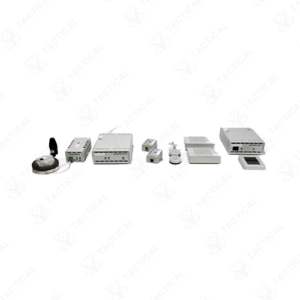
Tactical Supply Pakistan provides MonSX-compatible Windows Mobile handheld devices preconfigured with the software for seamless integration with SENSYS sensor systems. The company stocks Bluetooth GPS receivers and protective cases designed for demanding field conditions.
Does MonSX require internet connectivity to display field maps and borehole diagrams during remote survey?
No, MonSX performs all data visualization and map generation locally on the handheld device without internet access, ensuring full functionality in remote locations lacking cellular or satellite connectivity.
At Tactical Supply Pakistan, our relationship with you doesn't end after a sale. We are dedicated to making the long-term performance and reliability of our high-quality tactical and supplied equipment. Our commitment is to provide you with seamless support and peace of mind.
Fill out the form, and our team will respond promptly to assist with your product inquiries or order support.
WhatsApp us